
[ AN Mohammed ]
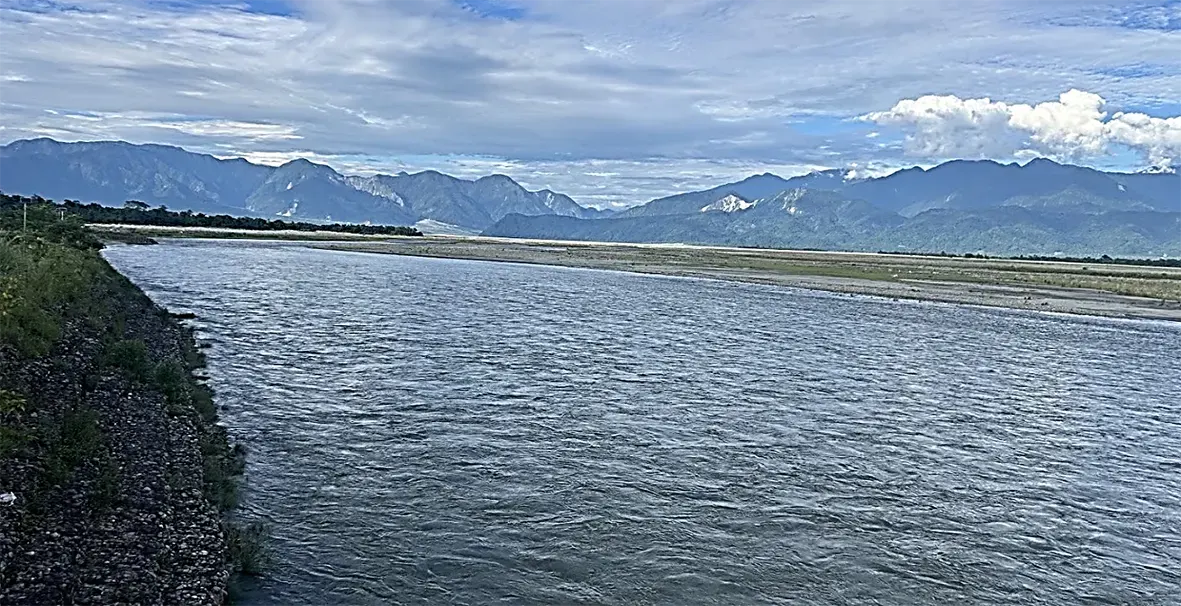
The Brahmaputra is a 2,880-kilometre transboundary river flowing through China, India and Bangladesh into the Bay of Bengal. It rises from the Ansi glacier, about 5,300 metres above sea level, near Mount Kailash in southwest Tibet. It runs about 1,700 kilometres through Tibet as the Yarlung Tsangpo, 278 kilometres through Arunachal Pradesh as the Siang, 642 kilometres through Assam as the Brahmaputra, and 260 kilometres through Bangladesh as the Jamuna.
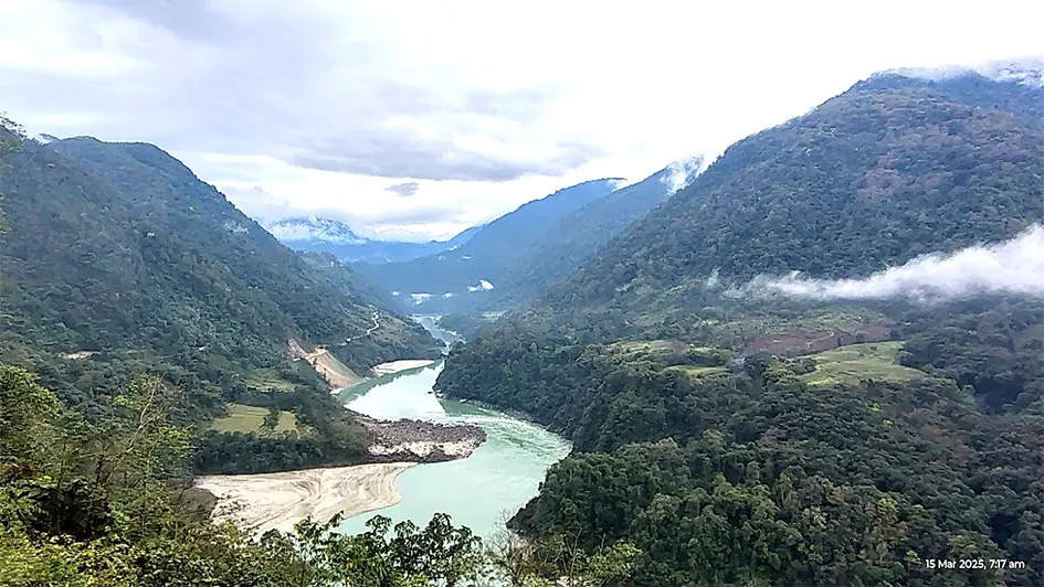
In western Tibet, it flows east along the Himalayas, curves around Namche Barwa and Gyala Peri, and enters Arunachal at Kepang La near Gelling, after making a dramatic southward turn, known as the Brahmaputra's Great Bend.
The Siang enters Arunachal carrying more than water. It carries three decades of Chinese silence about what happens to it upstream, and India's answer to that silence is still sitting on paper. Three separate facts - the river's own volatility, the scale of what China is now building on it, and the climate era both countries are living through - converge to make the case for the Siang Upper Multipurpose Project (SUMP) considerably stronger than it appears when each is examined alone.
A river that is volatile on its own
Begin with the river itself, because the danger it poses has nothing to do with China. Many studies show that the Brahmaputra valley has been affected by several extremely large floods in the past. In Tibet, huge lakes were formed when glaciers blocked rivers with rocks and debris. Some of these lakes held enormous amounts of water. When the natural dams broke, massive floods rushed into the Brahmaputra valley, carrying large amounts of sand and soil.
Evidence from river deposits shows that major floods occurred several times over the last 27,000 years, including one about 8,000 to 6,000 years ago and another about 1,200 to 1,650 years ago. Climate records suggest these floods happened during warm and rainy periods. As global temperatures continue to rise, similar conditions could increase the risk of more mega floods in the Brahmaputra valley in the future.
Over its final stretch through Tibet, the Yarlung Tsangpo is naturally erratic. At Nuxia, the last Chinese monitoring station, it flows near 6,000 cumecs during the monsoon and falls to as low as 500 cumecs in the lean season - a swing of more than tenfold within a single year. After Nuxia the river passes through the Yarlung Tsangpo Grand Canyon, a 240-kilometre gorge averaging 5,000 metres in depth and flanked by seventeen peaks above 6,000 metres, before merging with the Parlung Tsangpo and doubling in volume as it nears the Great Bend. This is also, not coincidentally, some of the most landslide- and avalanche-prone terrain on Earth.
Between Nuxia and India's first monitoring point in Tuting lies a 320-kilometre stretch with no real-time hydrological data whatsoever - a blind zone laid directly across the ground most likely to produce a sudden natural dam or a flash flood. India already knows what that blindness costs.
In April 2000, a landslide in Tibet blocked the river and formed a lake roughly 60 metres high; when it breached two months later, it killed about 30 people, left more than a hundred missing, raised water levels in Tuting by some 40 metres, destroyed infrastructure and left over 50,000 people homeless. That catastrophe required no dam, Chinese or Indian - only an unmonitored gorge and an unlucky season.
Between November and December 2017, the Siang experienced an unusual increase in turbidity, causing its waters to turn dark - affecting highly river ecology and raising concerns across Arunachal Assam. Dead fishes were seen floating near Pasighat. Satellite analysis by researchers from the National Centre for Biological Sciences (NCBS) indicated that an avalanche on the Sendapu glacier between 21 and 27 October, 2017 released large volumes of water, ice, rock, and mineral mixed sediment into the Yarlung Tsangpo, providing a plausible natural explanation for the river's discoloration. The situation was exacerbated by a M6.4 earthquake near Gyala Peri on 17 November, 2017, which triggered extensive landslides and formed several temporary landslide dams along the river upstream of India. Fortunately, the artificial dams instead of sudden break, slowly breached draining the water of the artificial lakes averting major disaster downstream in Arunachal and Assam.
Such incidences of abnormal flow variation and contamination of water are observed in the Siang from time to time. These events highlighted the vulnerability of the Siang-Brahmaputra basin to geologically induced disasters and underscored the need for continuous monitoring of upstream developments.
The rest of the Himalayan arc offers no reassurance that this was a one-off. In June 2013, a cloudburst and glacial-lake breach above Kedarnath in Uttarakhand sent a flash flood down the Mandakini valley that killed an estimated 5,000 to 6,000 pilgrims and residents and erased entire townships within hours. A decade later, on 4 October, 2023, the South Lhonak glacial lake in north Sikkim burst without warning, sweeping away the 1,200 mwTeesta III dam at Chungthang, killing more than forty people, and destroying bridges and highways as the flood travelled downstream through West Bengal into Bangladesh.
Nepal has fared no better: 2024 and 2025 alone brought a glacial lake outburst that tore through Thame village in the Everest region, a landslide that swept two passenger buses into the Trishuli River, October 2024 rains that killed roughly 250 people in and around Kathmandu, and a July 2025 glacial-lake burst on the China border that took out the Miteri Friendship bridge at Rasuwagadhi. Then, in late August 2026, a glacier collapse and ice-rock avalanche on the Nepal-Tibet border sent a wall of ice, mud and rock into the Bhote Koshi and Trishuli rivers, leaving more than a thousand confirmed dead and thousands still unaccounted for - one of the deadliest Himalayan disasters in living memory, and one that, again, no dam anywhere caused.
Assam itself was not spared that same season: weeks earlier, the Dikhow River had overwhelmed Sivasagar, Charaideo and Jorhat districts, killing around a hundred people, drowning whole villages and displacing hundreds of thousands across the state. None of these disasters required a dam upstream - Indian or Chinese - only the same unstable ice, steep terrain and monsoon intensity that define the Siang's own catchment. Glacial lake outburst floods and landslide-dammed lake failures are recorded across the Siang and Brahmaputra valleys going back thousands of years, and a warming Tibetan plateau is making the ice and slopes that trigger them less stable, not more.
This is the baseline hazard the valley lives with regardless of what gets built upstream, and it alone would justify a large regulating reservoir on the Indian side of the border.
China's Medog mega dam and the question of leverage
What China is now building on top of that baseline changes the calculation considerably. In December 2024, Beijing approved a 60,000 mw hydropower project at the Great Bend of the Tsangpo - nearly three times the capacity of the Three Gorges Dam and located barely 30 to 50 kilometres from the Arunachal border. Construction began within months of authorisation and is proceeding at a pace India's own careful, consultative clearance process was never designed to match; a formal construction ceremony was held in July 2025, and the project is expected eventually to generate close to 300 billion units of electricity a year through a network of tunnels bored into the Namcha Barwa massif.
China describes the design as run-of-the-river and environmentally benign, but the scale of tunnelling and diversion involved makes that claim hard to accept on faith, and the environmental impact assessments, storage figures and operating protocols that would let outside experts verify it have never been published. Hydrological data has been treated as a Chinese national security matter since 2020, and the limited data-sharing arrangement the two countries maintained since 2002 lapsed in June 2023 and has not been renewed.
Adding to the unease, Chinese geologists themselves published research in 2026 identifying an active fault running directly beneath the Medog site, in terrain long known to be seismically volatile - a warning that surfaced only after the project's own detailed design work was already complete, raising fair questions about how thorough that earlier study was.
None of this proves an intention to weaponise water. But it does mean that a state with which India has unresolved border tensions will soon control the headwaters of a river that governs daily and seasonal life for millions downstream, with the technical ability, if it ever chose to use it, to release water suddenly during the monsoon or restrict it through the dry season, and with no binding treaty obliging restraint either way. Sound strategic planning has to account for that capability, whether or not it is ever exercised - control over headwaters is control over consequence, and consequence is exactly what a downstream storage buffer of India's own would offset.
Climate change and the case for green energy
The third fact reframes the entire debate as more than a bilateral or a security question. Global warming does not respect the border either, and it is actively sharpening the two risks described above: the Tibetan plateau and Eastern Himalaya are warming faster than the global average, glaciers are retreating, and rainfall is becoming more erratic, which raises monsoon flood peaks in the short term even as it threatens leaner dry-season flows in the long term. Against this, India has committed under the Paris Agreement to 500 gw of non-fossil energy capacity and a 50 percent renewable share by 2030, on a path to net-zero emissions by 2070, alongside an additional carbon sink of up to 3 billion tonnes of CO2-equivalent through expanded forest cover.
Hydropower is central to meeting those targets, not incidental to them. It converts up to 90 percent of the energy it captures into electricity, against 30 to 45 percent for solar and wind, and a hydro plant can run efficiently for 50 to 100 years compared with 10 to 30 for a solar installation, without the land footprint, battery-disposal burden or weather dependency that limit renewables elsewhere in the mix. The Northeast holds roughly a quarter of India's assessed hydropower potential - some 58,000 mw by current reassessment - yet has developed barely 3 to 4 percent of it. Against this backdrop, the proposed 11,000 mw SUMP is no longer merely a power project. It is a test of whether India will build the capacity to manage what is coming down its rivers -or allow itself to be managed by it. A storage project on the Siang is therefore not a departure from India's climate commitments but one of the few pieces of infrastructure that advances them, generates clean power at scale, and buys flood security in the same stroke.
The Adi community and the deadlock
None of this, however, answers the hardest part of the problem, which is not hydrological or geopolitical but human. A section of the Adi community has opposed SUMP consistently and on serious grounds. Ancestral land along the Siang - Ane Siang, Mother Siang, to the Adi - is not a resource to them but the foundation of livelihood, culture and identity. Project opponents estimate that as many as 27 villages and over 1,00,000 people stand to be affected by submergence and displacement. The General Bogum Bokang Kebang has demanded the project's withdrawal outright, rejected the pre-feasibility process, and called for the removal of the central security forces deployed to enable surveys - deployment that, whatever its intent, has deepened fear and mistrust in villages like Parong, Riew and Beging, rather than easing it.
These are not objections that a stronger dam design or a bigger budget can simply override and treating them as an obstacle to be managed rather than a stake to be honoured is precisely what has stalled comparable projects for years, as the 2,000 mwSubansiri Lower project demonstrated when it took decades to reach construction and was then halted for nearly eight years.
Breaking the deadlock
Breaking that deadlock requires a different starting posture: engagement that is conditional and reciprocal rather than procedural. Four things would move it forward.
First, halt all forms of intimidation and harassment, and immediately withdraw the malicious, fictitious, and wholly unfounded investigations that have been weaponised against the leaders of the anti-dam movement. Replace the current mix of social survey teams and security deployment with sustained, honest, village-by-village consultation that lays out both sides of the ledger plainly - the flood and seismic risks building upstream regardless of what India does, and the water-security, flood-moderation, employment and infrastructure benefits a reservoir could bring - and does so without the presence of central forces that has itself become a source of fear.
The partial gains already visible, where several hundred households in Riga and majorities in Riew and Beging have signed on to the pre-feasibility process, show that engagement can shift opinion when it is not backed by coercion.
Second, rehabilitation and compensation should go well beyond the statutory minimum set by the 2013 land acquisition law: adequate replacement land, modern resettlement close to ancestral areas rather than distant relocation, livelihood support, preferential local employment on the project itself, education and healthcare guarantees, and a long-term share of project revenue, so that displaced families end up more secure than before rather than dislocated in the way the Chakma and Hajong communities were after the Kaptai dam in Bangladesh.
Third, commission a transparent, independently verified geotechnical, seismic and environmental safety case for SUMP itself, conducted and published to the same standard India is demanding of China for Medog - credibility on this point cannot be assumed, it has to be demonstrated, and demonstrating it would remove one of the Adi community's legitimate grounds for distrust.
Fourth, look to precedent within the region rather than starting from zero: the Dibang Multipurpose Project's engagement with the Idu Mishmi community, however imperfect, shows that patient, good-faith negotiation over years can eventually convert resistance into conditional support, and that pattern is more likely to succeed on the Siang than any attempt to accelerate consent through survey deadlines or force protection.
Conclusion
Taken together, the three underlying facts point firmly toward building the SUMP, and building it without further delay - a naturally volatile river running through an unmonitored gorge, an upstream mega dam whose operating rules India cannot verify or compel disclosure of, and a warming world raising the stakes on both. But the case for urgency on the engineering side does not licence urgency on the human side. The project will only be as secure as the trust it is built on, and that trust has to be earned from the Adi community through fairness, transparency and tangible benefit, not assumed as the price of national necessity. Project-affected communities must be made aware that the greatest danger they face is not merely the Chinese dam, but the looming spectre of extreme droughts and massive floods that could strike with a ferocity never before witnessed, engulfing entire settlements and shattering generations of progress and the Indian dam could be their last line of defence against such a devastating future. (AN Mohammed is a consultant in hydro project development in Northeast India.)