
(India's largest hydroelectric project - 2,880 MW and the country's tallest dam - promises clean power, flood relief for downstream and a lasting development dividend for Arunachal Pradesh.)
[ A.N Mohammed ]
The river and its catchment
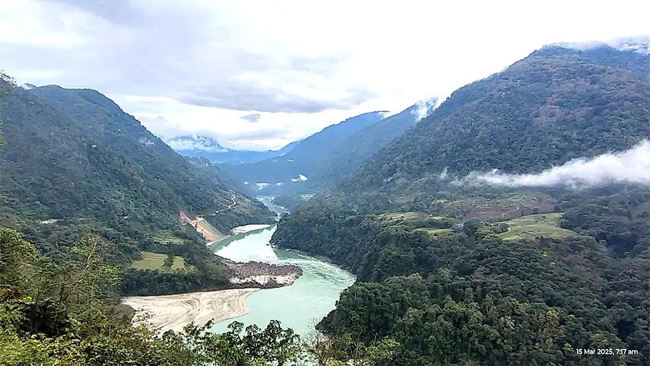
The Dibang rises near the Keya Pass on the Indo-China border, at more than 5,000 metres, and runs about 195 km from north to south through the Dibang Valley and Lower Dibang Valley districts of Arunachal Pradesh. Cutting deep gorges through the Mishmi Hills, it enters the plains at Nizamghat (Bomjir) and meets the Lohit and then the Siang near Sadiya in Assam, below which the combined stream is known as the Brahmaputra.
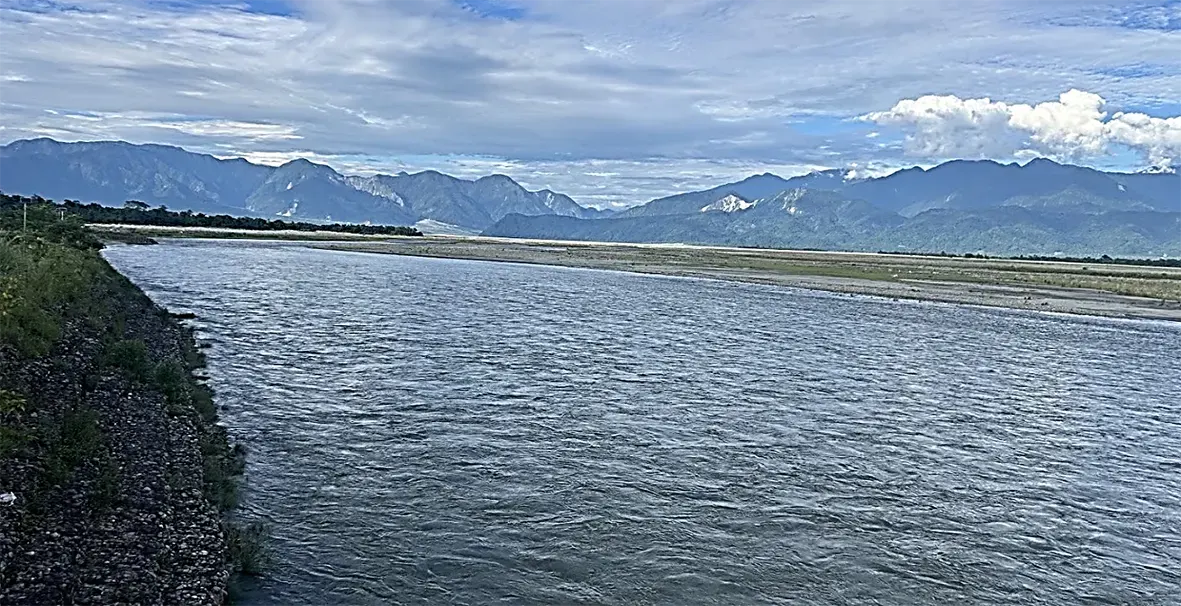
Its principal tributaries are the Mathun, Tangon, Dri, Ithun and Emra. The catchment up to the dam axis covers 11,276 sq km, of which 640 sq km is permanently snow-fed and 903 sq km lies in Tibet; the remaining 10,373 sq km is in Arunachal Pradesh. Below Dibang Multipurpose Project, the river flows 47 km in Arunachal Pradesh and 18 km in Assam with catchment area 1580 sq km and 261sq km respectively. Downstream of Nizamghat, the river loses its gradient and spreads into a braided channel four to nine kilometres wide. It shifts course frequently, flooding and swallowing farmland and forest along its banks - the very problem the project is designed to ease.
With an average annual runoff of about 28,020 million cubic metres, the Dibang contributes roughly 8.5 per cent of the Brahmaputra's flow at Pandu.
The project at a glance
Located about 1.5 km upstream of the confluence of the Ashupani and the Dibang, the project sits in steep, rugged terrain with a favourable combination of geology and topography. Its 278-metre concrete gravity dam, measured from the deepest foundation level, will be the highest in India. The spillway has eleven blocks with two levels of orifice openings, together able to pass the design flood of 19,000 cumecs; the probable maximum flood of 26,230 cumecs, approved by the Central Water Commission, is routed within the maximum water level.
The underground powerhouse complex has six head race tunnels (9.0 m dia., 300-600 m), six pressure shafts (7.5 m dia., 231 m), twelve penstocks (5.2 to 4 m dia), three main caverns (MIV, powerhouse of size 24.5 m x 56.3 m x 419 m, and transformer-cum-GIS-cum-draft tube), and six tail race tunnels (9 m dia., 320-470 m). Installed capacity is 2,880 MW from twelve 240 MW Francis units at a net rated head of 222.5 m.
During construction, the river will be diverted through five 12-metre-diameter tunnels, designed to handle a 1-in-25-year flood of 8,680 cumecs.
Construction of 278 m high and 798 m long concrete gravity dam across Dibang river will result in formation of a reservoir (approx. 35.64 sq km) with full reservoir level at EL530.3 m. Maximum Reservoir Level (MWL), Full Reservoir Level (FRL) & Minimum Draw Down Level (MDDL) of the proposed project are EL538m, EL530.3m and EL489.2m and the gross storage 3510.0, 3247.9 and 1965.3 Mcum, respectively. The back water in the reservoir will travel up to a length of 41 km in Dibang river and its various tributaries - Airi Pani, Ilu Pani, Imu Pani, Ahi, Ithun, Emra etc will facilitate promotion of navigation by connecting inaccessible upstream villages/areas.
Flood moderation: the central purpose
The Dibang project is conceived as a storage-based scheme in which flood moderation is the key objective, and it forms part of the Brahmaputra Board's master plan for controlling floods across the Brahmaputra's tributaries. By operating the reservoir to an approved rule curve, a flood cushion of 40.1 metres will absorb about 1,259 million cubic metres - roughly half the volume of three successive major floods. In the design scenario, a 1-in-100-year peak of 12,757 cumecs is cut to 3,000 cumecs, the safe carrying capacity of the river below the dam.
The relief in water level is of order of 1 to 2 meters beyond 20 km downstream of dam for 1-in-100-year flood, which is quite significant considering the fact that Dibang is quite a wide river in these reaches. Impact of flood moderation in Dibang Project is significantly beneficial for downstream as at just upstream of confluence with Lohit, for 100-year return period flood, relief of 0.76 meter in water level, 0.77 meter per second in velocity and 2060m in top width is envisaged.
Flood-prone width at the confluence point would shrink by about 1,608 metres (45 per cent), reclaiming an estimated 8,040 hectares for agriculture worth about Rs. 134 crore a year in paddy. Assam's flood losses averaged Rs.3,534.70 crore a year between 2014 and 2021; applying the Dibang's 8.5 per cent share, avoided damage is estimated at about Rs. 300 crore annually.
Daily peaking operations are expected to have little downstream effect: model studies show water-level fluctuation of only about 17 cm, spread over roughly six hours, at the Dibang-Lohit confluence, diminishing further towards Dibru-Saikhowa National Park.
Safety, sediment and the environment
Seismic safety: The project lies in Seismic Zone V. NHPC commissioned Local Earthquake Tomography through the Geological Survey of India (GSI) and magneto-telluric studies through the Indian Institute of Geomagnetism - a first for Indian dams, since incorporated into National Committee on Seismic Design Parameters guidelines. Site-specific parameters were developed by IIT Roorkee and CWPRS Pune, and international experts, including Dr. Martin Weiland of the International Commission on Large Dams (ICOLD) seismic subcommittee, advised on the design. The project's studies also note that the thrust-fault setting of the Himalaya is not conducive to reservoir-induced seismicity.
GLOF risk: Many glacial lakes in the Siang, Subansiri, Dibang, and Lohit systems lie far upstream, often on the Tibetan Plateau. Longer travel distances, gentler gradients in places, and large reservoirs can help attenuate flood peaks before they reach major infrastructure.
Sedimentation: Assuming a conservative rate of 0.1 ham/sq km/year, the annual sediment load is estimated at 11.276 million cubic metres. Even after 100 years, capacity at full reservoir level is projected at 2,277 million cubic metres.
Environmental flow: Under the February 2015 Environmental Clearance, 20 cumecs must be released continuously with at least one turbine run round the clock at full/ part load to sustain aquatic life downstream.
Forests and land: Of the 5,349 hectares required, 4,577.84 hectares is unclassified state forest, 701.30 ha is community land without forest cover and 70 ha is land with wet rice cultivation. The total area that would go under the water is 3,546 ha out of which 1,176 ha is the riverbed. The total land falls in Lower Dibang Valley and Dibang Valley districts. This has been offset by compensatory afforestation over 9,200 hectares of degraded forest through Compensatory Afforestation Fund Management and Planning Authority (CAMPA).
Construction materials: Approximately 216.0 lakh cum coarse aggregate, 108.0 lakh cum fine aggregate, 2.95 lakh tons Reinforcing Steel and 65.0 lakh tons Cement are required for concrete production for the construction of Dibang Multipurpose Project. Against the total requirement 447.0 lakh cum coarse & fine, 582.0 lakh cum suitable aggregate material is available from river shoal deposits in the nearby areas. The construction materials are proposed to be used from the riverbed materials as it has minimal impact on the environment.
From opposition to approval
The Brahmaputra Board began investigations in 2001-02 and prepared a pre-feasibility report in March 2002, proposing a 263-metre rockfill dam for 3,000 MW. The project transferred in December 2002, NHPC prepared the detailed project report for 288-meter concrete gravity dam. On the advice of the environment ministry, the dam height was reduced by 10 metres during Stage-I Forest Clearance and Environmental Clearance, bringing capacity to 2,880 MW.
The road was not smooth. Concerns among the Idu Mishmi community over displacement and environmental impact led to public hearings being deferred 14 times between May 2007 and October 2011. Sustained dialogue changed the mood, and residents took part in the hearings in March 2013. Two petitioners later challenged the Environmental Clearance before the National Green Tribunal. In its judgment of 11 October 2018, the Tribunal dismissed the petition, observing that adequate steps had been taken to harmonise ecology and development, and finding no reason to interfere with the clearance.
With all statutory clearances in place - technical, environmental, forest (Stage-I and Stage-II) and defence - the Cabinet Committee on Economic Affairs approved Rs.1,600 crore for pre-investment activities in July 2019, and gave investment approval in February 2023 at Rs. 31,876.39 crore, including Rs. 6,159.40 crore as budgetary support for flood moderation and Rs. 556.15 crore for enabling infrastructure. The Prime Minister laid the foundation stone on 9 March 2024. Overall financial progress of the project is 16.5 percent (up to August 2026).
Benefits for Arunachal Pradesh
Once commissioned, Arunachal Pradesh will receive 12 per cent free power (about 1,346.76 MU), while a further 1 per cent (about 112 MU) is earmarked for the Local Area Development Fund (LADF). Over the 40-year project life, the State's total benefit from free power and contribution to LADF is estimated at Rs. 26,785 crore.
In order to meet the infrastructure and developmental needs of local population, a specific provision of the LADF has been made by the Government of Arunachal Pradesh and guidelines in this regard have been notified on 15 June 2022. As per these guidelines, 1% additional free power of Dibang project would be earmarked for LADF, which shall amount to approximately Rs. 50 crore per year.
Further, the State Government shall provide a matching 1% from its share of 12% free power for local area development fund. With this, total fund for local area development will be approximately Rs. 100 crore per year on commissioning of the project.
Beyond this, the project provides Rs. 241 crore for community and social development, Rs 3.27 crore for a plan to protect local culture and identity, and about Rs. 500 crore for land compensation and rehabilitation. Roads and bridges built for the project will open up remote villages, and the reservoir's 41-km backwater will improve connectivity by water.
A milestone for the region and the nation
The Dibang Multipurpose Project is more than a power station. It is a flood-management asset for the plains of Arunachal Pradesh and Assam, a step towards the country's water security, and a source of 2,880 MW of clean energy for the national grid in support of India's goal of carbon neutrality by 2070. It will also strengthen India's hand in the Brahmaputra basin at a time when upstream activity across the border in China is growing. With completion targeted for February 2032, the coming years will test how well planning, community partnership and engineering come together on one of the most ambitious infrastructure undertakings in the Himalaya. (A.N Mohammed is a consultant in hydro project development in NE Region)