
[ Biren Dutta ]
The Eastern Himalaya has always lived with excess water, but what was once a season of heavy rain has, within a generation, become a cycle of sudden, violent flash floods.
This is not a danger confined to one state. Himachal Pradesh’ 2023 monsoon saw cloudbursts and flash floods devastate Kullu, Mandi and Shimla, sweeping away homes and roads; Uttarakhand has suffered repeatedly, from the 2013 Kedarnath disaster to the 2021 Chamoli glacier-burst flood on the Rishiganga; and Sikkim’s October 2023 South Lhonak glacial lake outburst sent a wall of water down the Teesta valley, destroying the Chungthang dam and claiming dozens of lives. Arunachal Pradesh, at the apex of the Brahmaputra basin, has in three consecutive monsoons witnessed events just as severe – severe enough to ask whether this is the new normal or only the beginning.
Flood versus flash flood
The two terms are often used loosely, but the distinction matters for warning and response. An ordinary flood builds over days as a river’s catchment saturates and discharge rises gradually, giving downstream communities time to prepare or evacuate. A flash flood, by contrast, develops within six hours of the triggering rainfall – often in under one hour in steep mountain catchments – and results from intense, localised rain, a cloudburst, or the sudden breach of a landslide or glacial dam, rather than gradual accumulation. It is this compressed timescale, not the volume of water alone, that makes flash floods so lethal in terrain like Arunachal’s, where a surge can strike a valley town before any conventional warning system has time to react.
Climatology of the Himalayan flash flood
The Himalaya is structurally predisposed to this kind of event: it forces moisture-laden monsoon air upward – the orographic effect – producing intense rainfall over short distances. Arunachal’s rivers, the Siang, Subansiri, Kameng, Lohit and Dibang, drop thousands of metres over a few hundred kilometres, among the steepest gradients in South Asia, so a surge from an ungauged upper catchment can reach valley towns with almost no warning.
A recurring pattern
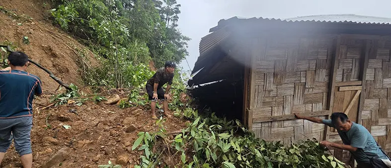
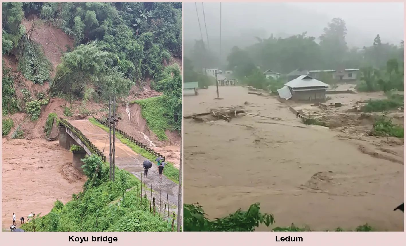
Recent monsoons show a clear pattern rather than isolated accidents. June 2024 brought red alerts across the state; June 2025 affected over 33,000 people, with Athunli village in Dibang Valley worst hit. 2026 has been the most severe yet. On 24 June, a cloudburst-triggered flash flood devastated the NEEPCO Colony in Possa in Keyi Panyor district, damaging around 30 houses and displacing dozens. In the same spell, East Siang district was battered – the swollen Sibo Korong river tore through Pasighat, threatened NH 13 near Raneghat, and floods at Ledum and Korang in Ruksin subdivision collapsed the Rema bridge and damaged over a dozen houses.
Neighbouring Lower Siang district was equally hard-hit: floods and landslides affected more than 3,100 people across 14 villages in the Nari-Koyu constituency, snapping road connectivity and isolating nearly 500 households, while a massive landslide at Siji dammed the Siji river, forcing an evacuation advisory for both Arunachal and downstream Assam. Barely weeks later, fresh flash floods in Kurung Kumey and landslides elsewhere killed seven and affected over 97,000 people statewide – exposing a real gap, since neither the IMD nor the Central Water Commission had flagged high risk for the worst-hit areas in advance.
Scientific drivers
Cloudburst-triggered flash floods are intense, highly localised convective rain cells. Cloudbursts can dump extreme rainfall over a small catchment in under an hour. Because the resulting peak discharge arrives almost as soon as the rain falls, this is the most immediate proximate driver of destruction, distinct from but amplified by the slower-acting factors below.
Global warming and moisture capacity: Warmer air holds more moisture (the Clausius-Clapeyron relation), so rain falls harder in shorter, more violent bursts, rather than more often.
Rising greenhouse gases: The build-up of carbon dioxide and methane drives the warming above, intensifying evaporation from the Bay of Bengal and making the monsoon more erratic – long dry spells punctuated by extreme wet ones.
Glacial retreat: Shrinking glaciers feed expanding, unstable glacial lakes; a glacial lake outburst flood (GLOF) can release weeks’ worth of river flow in minutes.
Deforestation, including illegal logging: Forest cover slows rainfall, binds soil, and aids infiltration. Legal clearing for roads and jhum is compounded by illegal and unregulated felling on steep slopes, which strips this protection faster than it can regenerate and turns hours of runoff time into minutes.
Unstable young geology: Landslides frequently dam small streams; their sudden breach mimics a cloudburst even without extraordinary rainfall, as seen at Possa and Siji.
Unregulated infrastructure in flood paths: Colonies and roads built on stream courses, as at the NEEPCO site, sit exactly where the water discharges hardest.
Forecast: A trend towards greater frequency and destruction
Among all natural hazards facing the Eastern Himalaya today, flash flood has emerged as the most imminent and immediate danger of recent years – more sudden, less predictable, and more frequently fatal than almost any other disaster the region faces. These mechanisms point one way. Climate projections show intensifying short-duration rainfall, continued glacial retreat, and more glacial lakes at previously stable altitudes. Three consecutive damaging monsoons, each catching the system partly by surprise, are consistent with science, not bad luck. As global warming and worldwide climate change continue to intensify rather than reverse, this threat is set only to sharpen: flash floods across the Himalaya, and in Arunachal in particular, must be expected to grow more frequent and more destructive in the years ahead, not less.
Without stronger monitoring and land-use control, this trajectory will only steepen.
Vulnerability
Vulnerability turns a flood into a disaster. Most exposed are villages on river terraces and confluences, hydropower colonies built near river courses, remote settlements with a single access road, and newer districts where monitoring has not caught up. Poverty limits the ability to recover without external support.
Risk zonation of Arunachal Zone I: High-altitude/glacial catchments (Upper Siang, Upper Subansiri, Tawang, West Kameng, and the upper reaches of Dibang Valley): GLOF and cloudburst risk; priority is glacial lake mapping.
Zone II: Mid-hill valley districts (Kurung Kumey, Keyi Panyor, East & West Siang, Lower Siang, Dibang Valley, Siang): highest recorded damage; priority is dense gauging and construction setbacks.
Zone III: Foothill/plains-transition districts (Namsai, Lohit, Changlang, lower Papum Pare): combined hill-flood and backwater effect; priority is coordinated warning with Assam.
Protective measures
# Densify automatic weather stations and stream gauges in every district.
# Enforce no-construction zones along stream courses and relocate existing at-risk infrastructure.
# Map glacial lakes and landslide-dammed streams using satellite imagery, updated regularly.
# Curb illegal logging and restore forest cover on steep slopes through community forestry.
# Build village-level early-warning systems. Sirens, trained wardens, rehearsed evacuation routes.
# Build climate-resilient roads and bridges. Hilly stretches should use elevated and reinforced bridge designs with adequate waterway clearance, retaining walls and slope stabilisation (bio-engineering plus gabion/breast walls) on cut slopes, and culverts sized for extreme rainfall rather than average flow, so that key links like NH 13 and the Rema bridge do not fail at the first cloudburst.
# Strengthen redundant connectivity (alternate bridges/routes) for isolated villages.
# Extend insurance and compensation to households in mapped hazard zones.
Remote sensing and the meteorological department
Satellite remote sensing (ISRO’s Bhuvan/NRSC) is essential in terrain too rugged for ground access – tracking glacial lakes, estimating rainfall over ungauged catchments, mapping landslide susceptibility, and producing near-real-time flood-extent maps after events. Paired with denser IMD and Central Water Commission ground telemetry, this is the realistic path to a genuine early-warning lead time.
Role of stakeholders
The IMD and the CWC must close the data gaps highlighted by recent events. The ISRO and remote-sensing agencies must expand glacial and landslide mapping. State departments – Disaster Management, Forest, WRD, RWD – must enforce zoning, restrict settlement along narrow river valleys, and check illegal logging. District administrations and panchayats are the first responders. The Army, ITBP and Assam Rifles provide critical rescue capacity, as seen in Lower Siang and East Siang this year.
Civil society and village institutions hold irreplaceable local knowledge. Media and educational institutions must build public awareness of warning signs.
Given the scale and recurrence of the threat, these same stakeholders – the State Disaster Management Authority, IMD and CWC, ISRO, the Forest and WRD Departments, district administrations, panchayati raj institutions and community organisations – must now come together to frame a dedicated, standing preventive policy for flash flood mitigation, rather than responding afresh after each monsoon.
Such a policy should fix accountability, timelines and funding for monitoring, zoning and early-warning measures well before the rains arrive.
Conclusion
Arunachal did not choose its geography, but the scale of disaster it now suffers is being worsened by global warming, greenhouse gases, illegal logging and deforestation, and unplanned settlement in harm’s way. The last three monsoons – including this year’s damage in Keyi Panyor, East Siang and Lower Siang – suggest the state stands at the threshold of more frequent, more destructive flash floods. The response must be built in advance, not assembled after the water arrives. (The writer is Principal, DIET, Roing, Lower Dibang Valley. The views expressed are personal.)